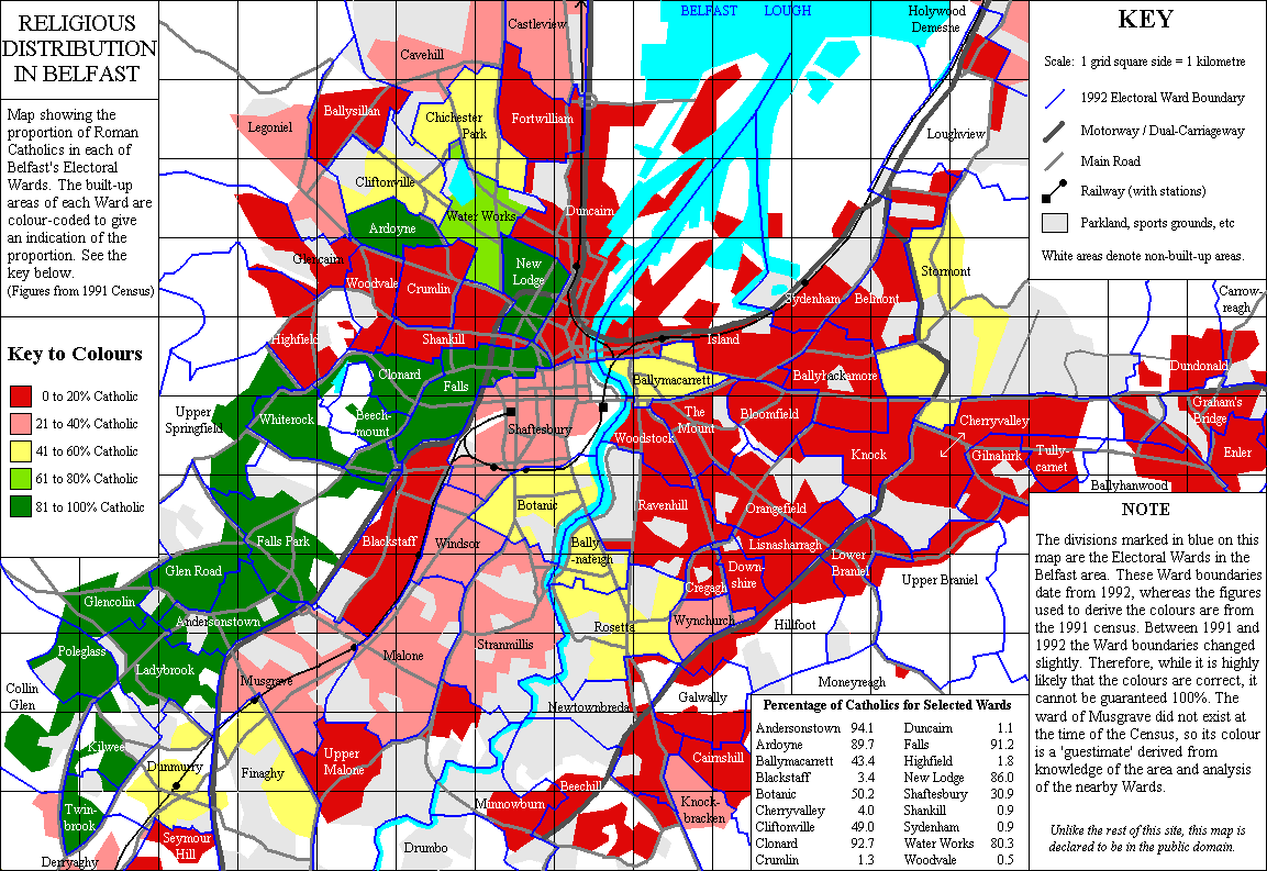
The above map is a religious distribution map of Belfast in 1991. Granted, demographics may have changed since then but there are still places where you should exercise caution. The red are predominantly Protestant areas and the green are predominantly Catholic. I wouldn't say all of them are unsafe areas (compared to that of the United States), but religious and political tensions still simmer in these neighborhoods. Just because you don't see bombs going off anymore, doesn't mean that Belfast is one big utopia where the Protestant and Catholics are holding hands frolicking through a field of daisies.
The few months I have been here, the political and social climate are still an enigma to me, and it's hard to ask people who are just mere acquaintances what their take on the situation is because you never know where they stand and who they know. And as an outsider, no matter how much you've studied on the subject or how long you've lived here, to a Belfastian, you are not and never will be an authority on the subject so it is best to keep your mouth shut and your ears open.
The following neighborhoods are where I know I should tread carefully. These are places where I wouldn't exactly flaunt my Celtic (Catholic) or Rangers (Protestant) wear. If you do, you will be asking for trouble. I'm sure there are more neighborhoods but these are areas I know of so far.
Protestant Neighborhoods:
Ballysillan
Donegal Road
Lower Newtonards Road
Shankill
Sandy Row
Suffolk
Tiger's Bay
Tully Carnet
Upper Ormeau Road
Woodvale
Catholic:
Andersonstown
Ardoyne
Ballymurphy
Falls Road
Lagmore
Lagoniel
Lower Ormeau Road.
Poleglass
Short Strand
The following are neutral areas where tensions are low or non-existant:
Antrim Road
Belfast City Centre
Botanic Avenue
Dublin Road
Some parts of Lisburn Road
Malone Road but not Upper Malone
Stranmillis
Upper Newtonards Road


No comments:
Post a Comment